FAEDISNICE
Getting to know Faedis
> FAEDIS AND ITS TERRITORY
> WHERE WE ARE
> HOW TO REACH FAEDIS
> THE COMMUNE OF FAEDIS
> USEFUL ADDRESSED
Counting about 1600 inhabitants, Faedis is a village situated close to the Prealpi Giulie, right at the mouth of the Grivò torrent valley, an essential source of income for the development of these places.
Faedis, from ‘fagetum’ a beech forest, made its entry into history shortly after the year 1000 when the Aquileian patriarch Popone gave permission to Odorico of Auspergh, a Carinthian nobleman, to erect a castle.
The history of our village was strongly marked by the presence of this noble family, which took the name of Cucagna, subsequently branching out as Zucco and Freschi families. The legacy of such past times became a reason for the appeal of our territory, which not only is immersed in nature, but can exhibit beautiful castle ruins, villas and many votive churches. Cucagna, and from which the Zucco and the Fresh, the legacy of this past is now a point of attraction for this area that, in addition to the nature in which it is immersed, can boast the remains of castles the villas, and also the numerous votive churches.
A visit to Faedis gives you the chance to immerse yourself in an environment that offers a variety of leisure options from walks along forest paths and hillsides, visits to castles and churches, in short, in a rather small area there are numerous places of interest concentrated, just waiting to be discovered.
FAEDIS AND ITS
TERRITORY
“At the foot of the Julian Pre-Alps, in one of the most fertile and picturesque valleys in Friuli, surrounded by greenery and peace, lies Faedis.
From the pre-Alpine backdrop, two short chains of chestnut-covered mountains branch off and decline towards the plain, where they immediately give way to two wings of smiling hills, which undulate and softly stretch down beyond the village: they look like two motherly arms stretching out in the embrace of the entire valley.
So wrote Don Piccini in 1934 in the introduction to the book on the history of the parish. From that time to the present day, things have changed very little: the landscape has modernised, there are more houses, roads, power lines, etc., but the feeling and atmosphere that one breathes have remained the same.
(Pictured above, Canebola and the Grivò valley at whose outlet on the Friulian plain lies Faedis)
The municipality of Faedis offers the opportunity to relax in a green environment far from the stress that has become a faithful companion of modern life. In addition to this, there is the remarkable artistic heritage, including the castles and numerous votive churches that characterise the landscape, the various events organised especially in the
summer months and finally, for lovers, the good old glass of wine that can be sipped in the cellars and bars of the villages.
The itineraries that we can suggest are mostly long walks through the various forests of the hills and mountains in the area, lasting about ten hours at most. Two-wheel enthusiasts can also find interesting routes in Faedis: let us recall the ascent to Canebola, or to Valle or Costalunga; challenging roads that can be tackled either by road bike or mountain bike.
By using this second means, one can take advantage of more suitable routes, such as certain paths and forest roads. The various excursions can be accompanied by a stop in some wine cellar to drink a good glass of wine or in some restaurant, where you can find the flavours of good Friulian and other cuisine. Particularly suitable for this is the itinerary among the artistic beauties of the municipality, which allows you to use your car for almost the entire route, thus shortening the time and allowing for a few long stops.
WHERE
WE ARE
HOW
TO REACH FAEDIS
CAR
FROM UDINE, 15-20 min., along SP 15 (15 km)
FROM CIVIDALE DEL FRIULI, 10 min., along SR 356 direction Tarcento
FROM TARCENTO, 15-20 min., along SR 356 direction Cividale (15 km)
MOTORWAY
If arriving by motorway, you should take the UDINE NORD exit. Once off the motorway, you must proceed to Cividale-Povoletto and a 15-20 minutes drive takes you to Faedis.
PUBLIC TRANSPORT
SAF provides public transportation services from Monday to Saturday, connecting Faedis to Udine and Cividale
Timetables available at: www.saf.ud.it
TRAIN
The nearest railway station is in Udine. Due to its proximity to the bus station (exit the station about 100m to the right), it makes it possible to continue the journey by bus quite easily, Bus timetables: www.saf.ud.it
AIRPLANE
The nearest airport is Ronchi dei Legionari (Trieste Airport).. Easily accessible by car thanks to excellent connections to the regional road and motorway network.
THE
COMMUNE
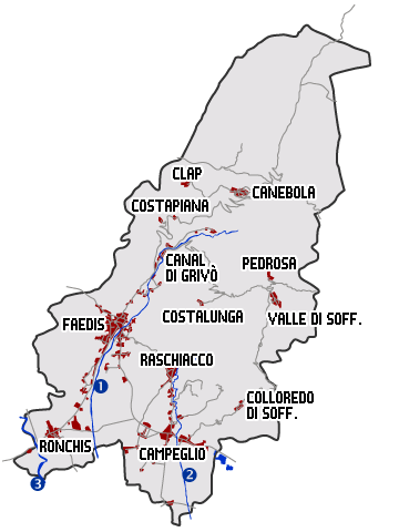
Faedis and its area are situated right near the Colli Orientali del Friuli, the Grivò torrent flows through its whole territory.
Up north, the Mount Joanaz towers over the whole valley; it brings back memories of the past Partisan Resistance war, together with the Porzus Alp and the small fractions of Clap and Canebola. It also serves as morphological limit of a border land. Numerous hamlets and rural villages were born and developed on the slopes of these mountains. These agglomerations are connected by roads and paths.
Surface: 46,61 Kmq.
(20% Lowlands, 35% Hill, 45% Mountain)
Abitants: 2945 (1455 M – 1490 F / 1297 fam.) gen. 2017
Borders: a N with Slovenia and the communes of Taipana and Pulfero, to E with the commune of Torreano, a S with the commune of Remanzacco, a O with the commune of Povoletto and to NO with the commune of Attimis
Torrents: Grivò di Faedis (1), Grivò di Raschiacco (2), Malina (3)
FAEDIS
abitants: 1481
height on sea: 170 mt
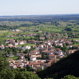
It is the main centre of the Commune. It is situated at the mouth of the Grivò Valley, in a place surrounded by hills and greenery. Quoted for the first time in 1027, it is a historically rich village and belonged to the Cucagna family until the XVIIIth Century. Faedis was born as a junction of neighborhoods, situated on both sides of the river. By growing and growing they gave origin to the main town.
CAMPEGLIO
abitants: 771
height on sea: 135 mt
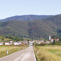
Campeglio is the second main town in the whole Municipality. It is an ancient location, as the ruins of the Soffumbergo castle demonstrate, a summer mansion for the Patriarch of Aquileia. The Mosaic of San Michele is particularly suggestive. Find it in the parish church, rebuilt after the 1976 earthquake. The village stretches itself along the road to Cividale.
RASCHIACCIO
abitants: 214
height on sea: 179 mt
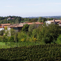
Raschiacco was first mentioned in 1321. The village grew around the small San Martino Church, which many historians believe to be from the year 1200. Raschiacco is situated at the feet of the hills, in the middle of numerous vineyards, which are the origin of many excellent wines.
RONCHIS
abitants: 159
height on sea: 129 mt
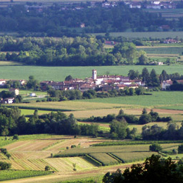
Ronchis played a very important role in the history of the Commune of Faedis. During the XVth Century its two villas, Freschi and Partistagno actually became the main residences of the two noble families of the same name, originating from the Cucagna dynasty. This fraction is situated along the road to Udine and mainly grew around its tiny square.
CANAL DI GRIVÒ
abitants: 103
height on sea: 228 mt
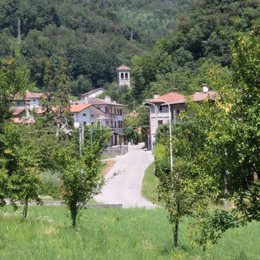
Confirmed information about this village was only to be had during the Cucagna times, although studying the ethymology of its name, clearly Celtic, guesses about even more ancient origins are not unjustified. Canal di Grivò is situated on the banks of the torrent bearing the same name, right where the two mountains are closer to each other, resulting in a sort of creek.
CANEBOLA
abitants: 110
height on sea: 669 mt
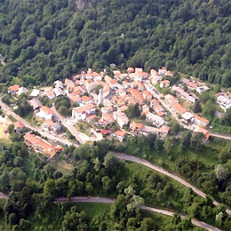
Faedis is the capital of the municipality. It stands at the mouth of the Grivò valley, in a place surrounded by hills and greenery. First mentioned in 1027, it is a village rich in history and belonged to the Cucagna family until the 18th century. Faedis is made up of several hamlets, located on either side of the Grivò stream, which expanded to form the village.
VALLE DI SOFFUMBERGO
abitants: 13
height on sea: 678 mt
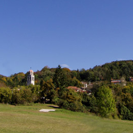
Valle is also called “a view on Friuli”. Like all the other villages nearby, it has ancient origins.
During the past centuries, it belonged to the Soffumbergo feud, which was owned by the Aquileia Church. The village developed around the San Pietro Church, dating back to the XVIIIth century. Most of its buildings are renovated country houses, used mainly as holiday resorts
(For information on activities in Valle: www.prolocovalledisoffumbergo.it)
STREMIZ
abitants: 29
height on sea: 315 mt
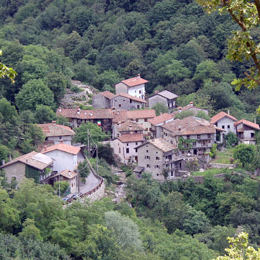
Stremiz was first quoted and heard of in 1294. Its territory was under the Cucagna jurisdiction, starting from the XIIIth Century. This country village consists of some sparse buildings, built along the streets and around the tiny square, in which a beautiful fountain from the XIXth Century shows itself. In the past, four mills were there. Three of them survive and near two of them, by the source of the Grivò torrent, there is a stone bridge of Roman origin.
COSTAPIANA e GRADISCHIUTTA
abitants: 22
height on sea: 389 mt
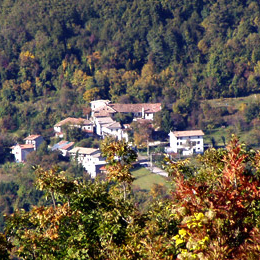
Costapiana is a very small village, along the road to Canebola. It’s an ancient neighborhood, although it’s quite difficult to clearly understand its actual origins. Not too far from it, lies the neighborhood of Gradischiutta, 364 meters above the sea level, whose name means “fortified place” or “castle ruins”. It was probably built on the ruins of an ancient fort.
COLLOREDO DI SOFFUMBERGO
abitants: 21
height on sea: 273 mt
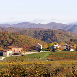
Colloredo was first quoted in 1501 as Villa Coloreti Soffumbergi. Its name has Latin origins and it is supposed to mean “walnut wood”. Like nearby villages, the Colloredo history had strong ties with the Soffumbergo Castle. These days, it is a small village, mainly known for its wine production.
COSTALUNGA
abitants: 6
height on sea: 593 mt
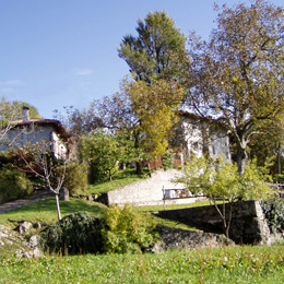
Costalunga was first quoted in 1353, but not unlike Canebola, even more ancient origins can be guessed. It was initially under the Cucagna jurisidiction, but later it was under the Soffumbergos. It is situated on a hill between the Grivò, Faedis and Raschiacco valleys. In recent years, the village has been completely restored, becoming a precious rural neighborhood.
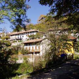
PEDROSA
abitants: 1
height on sea: 754 mt
Pedrosa was first mentioned around the half of the XIVth Century. This small suburb was usually mentioned alongside Costalunga, in relation to a few historical facts regarding the Cucagna household.
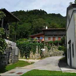
CLAP
abitants: 4
height on sea: 684 mt
Similarly to Canebola, Clap probably originated during the Slavic migration time. The village is now unhabited, even if some of its houses were restored after the 1976 earthquake, and are still used as summer holiday resorts. Actually, this is an ideal place to relax and be in touch with nature.
The main suburbs are: Casali De Luca e Case Cos (between Ronchis and Faedis), Borgo Scubla e Canal del Ferro di sotto e di sopra (between Faedis and Canal di Grivo’), Canale (near Campeglio), Case Prà della Roggia e Case Presa (south of Campeglio)
USEFUL ADDRESSES
USEFUL
FIORITTO DI FIORITTO GIANLUCA
Piazza I° maggio – FAEDIS
Riparazioni Biciclette
Tel. 0432 728010
Click here to see how to get there
FABRIS PAOLO & C – GARAGE
Via Soffumbergo, 51 – CAMPEGLIO
0432 711055
Click here to see how to get there
CARABINIERI – Stazione di Faedis
Piazza Monsignor Pelizzo, 13
Tel. 0432 728739
Click here to see how to get there
IP – Petrol Station
Via Udine – FAEDIS
Autolavaggio
Tel. 0432 728603
Click here to see how to get there